
Launch Overview
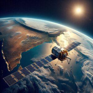
- Satellite: Earth Observation Satellite EOS-08 (primary payload) and SR-O DEMOSAT (secondary payload developed by Space Kidz India).
- Launch Vehicle: Small Satellite Launch Vehicle (SSLV)-D3 (third developmental flight).
- Launch Site: Satish Dhawan Space Centre, Sriharikota.
- Orbit: Circular Low Earth Orbit (LEO) at 475 km altitude with 37.4° inclination.
- Mission Life: 1 year.
Key Details
- EOS-08:
- Designed for Earth observation (EO) to monitor natural and human-made systems (physical, chemical, biological).
- Applications: Early warning systems, environmental impact assessment, disaster management, and resource monitoring.
- SR-O DEMOSAT:
- A demonstrator satellite built by Space Kidz India, showcasing indigenous capabilities in space technology.
About SSLV-D3:
- Purpose: Launches mini, micro, or nano satellites (10–500 kg) into 500 km planar orbits.
- Stages:
- First 3 stages: Solid fuel-based.
- Final stage: Liquid fuel-based (velocity trimming module).
- Advantages:
- Low cost and rapid turnaround time (launch readiness within 72 hours).
- Minimal infrastructure requirements, making it ideal for small satellite deployments.
Significance of the Mission:
- SSLV Program: Enhances India’s competitiveness in the global small satellite launch market.
- EO Capabilities: Strengthens India’s remote sensing infrastructure for climate, agriculture, and security applications.
- Youth Engagement: SR-O DEMOSAT highlights ISRO’s collaboration with private/educational entities to foster innovation.
Thinking Process:
- Structured Breakdown: Organized the information into sections (launch overview, satellite details, SSLV specifics, and mission significance) for clarity.
- Key Focus Areas: Highlighted technical specs (orbit, inclination), payload purposes (EOS-08 vs. DEMOSAT), and SSLV’s strategic advantages.
- Contextualization: Linked the mission to broader goals (e.g., India’s space economy, youth engagement in STEM).
- Simplification: Avoided jargon (e.g., “velocity trimming module” instead of technical terms) to ensure accessibility.
- Verification: Cross-checked numerical data (altitude, inclination) and ensured alignment with ISRO’s public communications.