
Context
- An ISRO study (2025) on the Dharali flash flood (Uttarakhand) found that it was triggered by the collapse of an exposed ice patch on the Srikanta Glacier.
- This shifts the focus from large Glacial Lake Outburst Floods (GLOFs) to smaller, less visible cryospheric instabilities caused by rapid deglaciation.
- It highlights the need to monitor not just glaciers and lakes, but also micro-level changes in ice structure.
What is Glacier Melting?
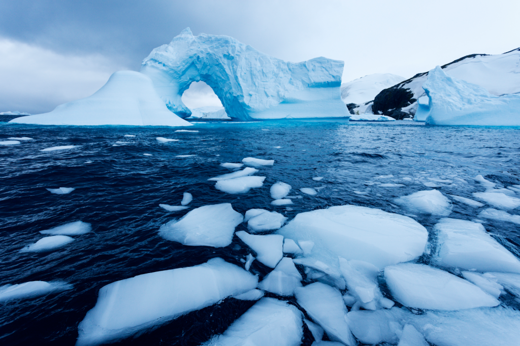
- Glacier melting (deglaciation) refers to the reduction in glacier mass when melting exceeds snow accumulation.
- Rising temperatures thin the protective snow and firn layer, exposing older and unstable ice patches.
- These exposed patches become vulnerable to collapse, triggering sudden disasters in downstream regions.
Data and Key Trends
- Himalayan glaciers are losing ice at about 0.5 metres per year since 2000.
- The Hindu Kush Himalaya region is warming faster than the global average, with projections of up to 75% glacier loss by 2100.
- Around 1.3 billion people depend on rivers originating from these glaciers.
- The frequency of GLOFs and ice-collapse events has tripled in the last two decades.
Causes of Accelerated Glacier Melting
- Rising temperatures: Reduced snow cover exposes darker ice, increasing melt rates.
- Black carbon deposition: Pollutants absorb heat and accelerate glacier retreat (e.g., Gangotri region).
- Changing precipitation: Shift from snowfall to rainfall reduces glacier recharge (e.g., Ladakh).
- Infrastructure pressure: Roads and tunnelling create local instability and heat effects (e.g., Char Dham project).
- Geomorphic processes: Freeze-thaw cycles create nivation hollows, leading to sudden collapses (e.g., Dharali event).
Impacts and Risks
- Water insecurity: Initial increase in river flow is followed by long-term decline, affecting millions.
- Disaster vulnerability: Sudden floods in narrow valleys cause high human and economic losses.
- Evolving hazards: Risks are no longer limited to lakes but include ice-patch collapses and avalanches.
- Local exposure: Settlements like Dharali village face direct threat due to proximity to glacier-fed streams.
Initiatives Taken
- National Mission for Sustaining the Himalayan Ecosystem (NMSHE): Focus on glacier and ecosystem monitoring.
- ISRO satellite mapping: Monitoring over 9,500 glaciers using advanced imagery.
- Early Warning Systems (EWS): Installed in vulnerable valleys after recent disasters.
- International collaboration: Programs like Indo-Swiss partnerships for glaciology research.
Challenges
- Difficult terrain: High-altitude regions limit installation and maintenance of monitoring systems.
- Data gaps: Lack of historical data hinders prediction of rare events like ice collapses.
- Transboundary issues: Glaciers span multiple countries, complicating coordination.
- Socio-economic vulnerability: Communities in fragile terrains face disproportionate risks.
- Unpredictable weather: Sudden micro-climatic changes reduce effectiveness of forecasts.
Way Forward
- Integrated monitoring: Combine satellite data with ground-based sensors for real-time tracking.
- Community awareness: Train local populations to identify early warning signs.
- Sustainable infrastructure: Enforce strict environmental checks in fragile zones.
- Regional cooperation: Strengthen data sharing across Himalayan countries.
- Focused mapping: Identify and monitor geomorphologically sensitive zones like nivation hollows.
Conclusion
- The Dharali incident shows that Himalayan risks are becoming more complex and less visible. Addressing glacier-related hazards now requires a shift from isolated monitoring to a holistic ridge-to-valley approach, ensuring both environmental protection and human safety.